In Iceland there are some less known routes, out of the classic tourist routes, which offer equally spectacular landscapes without crowds.
The Iceland is among the most popular destinations in recent years, especially in the summer when temperatures are less rigid and you can hike outside enjoying the breathtaking landscapes for which the island is famous. It is the idea that they all have a little bit of tourists, that of organizing a trip between July and August in Iceland, which is why the main attractions, volcanoes, waterfalls, thermal pools and of course Reykjavík, the Capital, distributed along the Ring Road, they are super crowded.
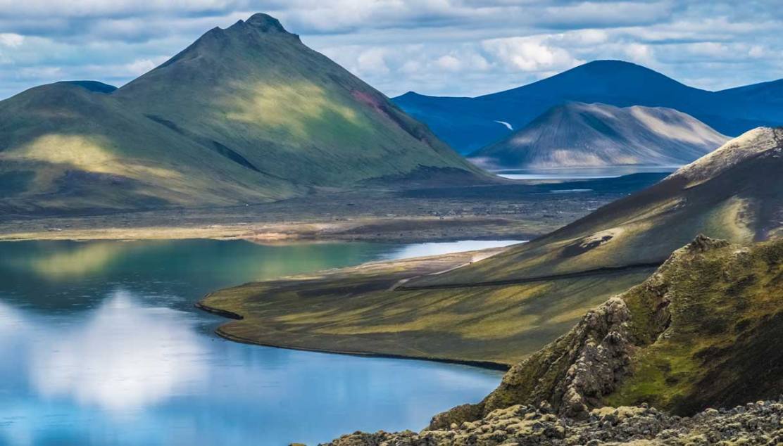
There are, however, some less known routes, out of the classic tourist routes, which offer equally spectacular scenery without crowds, however. The area between the Mýrdalsjökull glacier, which lies to the south of the island, and the Torfajökull glacier, a little further north, in the Fjallabak Nature Reserve, is absolutely incredible. The region is difficult to access and is characterized by extreme contrasts of morphologies and environments.
The Mýrdalsjökull is 1,493 meters high and, under its ice cap, lies the quiescent volcano Katla which has a caldera with a diameter of about 10 kilometers and which, in the last centuries, has erupted at intervals between 20 and 80 years. Since the last eruption was in 1918, it is constantly monitored. The Torfajökull glacier is smaller and 1190 meters high. To this place are linked some local legends that are still handed down.

Halfway between the two glaciers you can admire Mount Mælifell, a cone of fluorescent moss in a sea of black sand a few kilometers from Torfajökull, formed approximately 10 thousand years ago after the last ice age. It can only be reached on board a 4 × 4.
You may also like to read: Seven ice hotels for vacationers on the beach
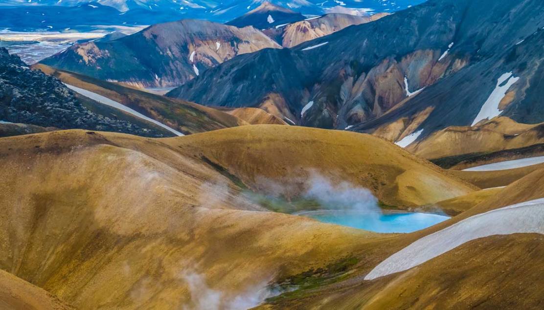
This region is crossed by the path of one of the most beautiful trekking in the world, the famous Laugavegur Trail, which in Iceland means ‘the path of the hot springs’. About 55 kilometers long, it starts from the thermal springs of Landmannalaugar and reaches the glacial valley of Þórsmörk, crossing a wide variety of landscapes made of lava flows, basins covered with black stone and watercourses.
We are in the second largest geothermal area on the island after Grímsvötn, in the Vatnajökull National Park. As a manifestation of this geothermal activity, it is possible to admire the alterations of the rocks that take on the most disparate colors ranging from red to yellow and from blue to green. A true artist palette.
You can stop in the five shelters that you encounter on the way and that offer hot meals and comfortable beds. During the summer season, Landmannalaugar, Þórsmörk and Skógar are connected to Reykjavík by a bus service.
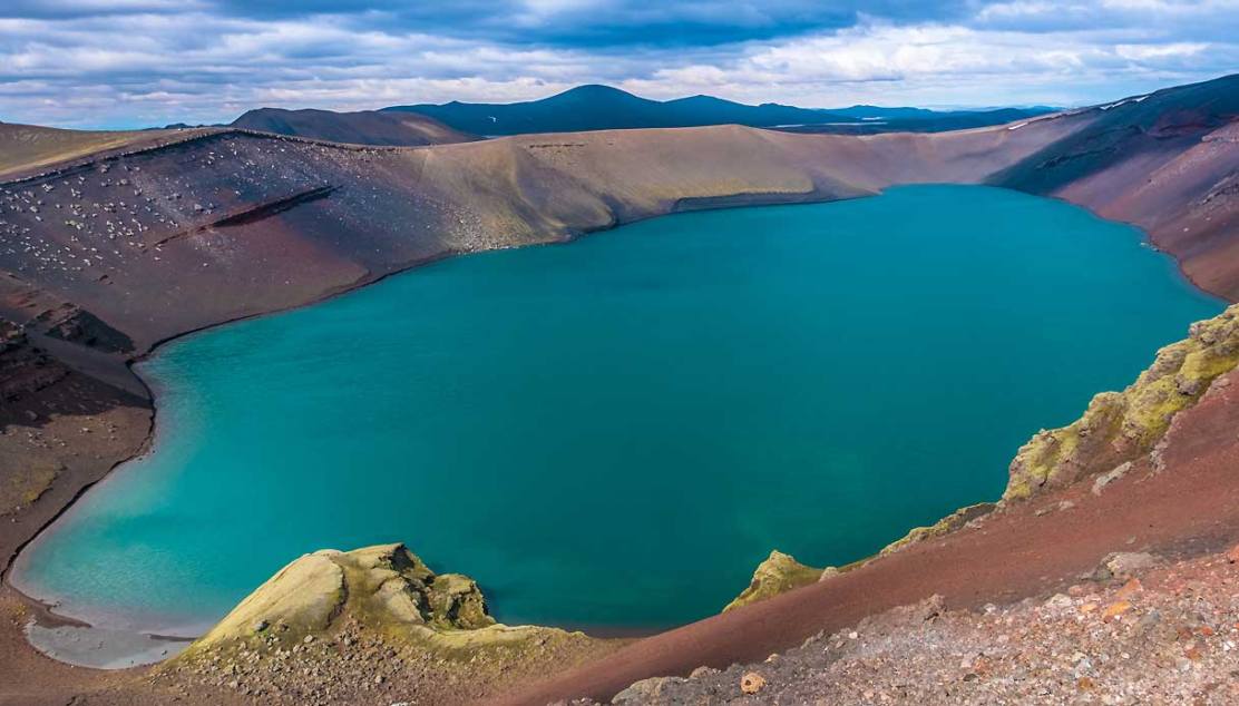
Along the way to one of the shelters, the Hvanngil, you cross the southern sector of the Fjallabak nature reserve. This region is a true masterpiece of nature, made of lakes that create beautiful contrasts of colors as only in Iceland can be admired.